Our Favorite Cycling Route Planning Apps
We hope this finds you in good health during this very challenging time for our world. Although our primary focus is on the health and wellbeing of our staff and communities, we are still planning for and designing backcountry bike trips on our public lands.
To break-up the constant news feed, I thought I could share a few tools that we use to research new trips. Of course, the heart of our research is going and getting lost down a forgotten gravel road, or searching out rumors of an improved trail and sleeping underneath the stars. Still, we do put a significant amount of time into researching the details behind the scenes. Being that many of us are spending more time on our computers and devices right now, I thought I would share some useful online apps to create incredible backcountry experiences.
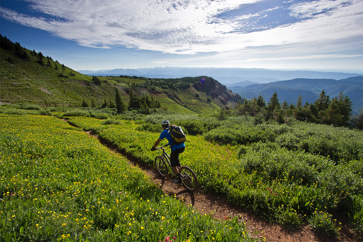
It’s worth mentioning that APP ≠ BACKCOUNTRY, right? The most enriching aspect of a backcountry trip is the non-human part of it. Most of us spend the better part of our lives engulfed in manufactured environments. Our public lands are our national treasures because they remain relatively unimpacted by humans, and that is the very reason that we go there. To engulf one’s self in technology while in the backcountry easily removes the magic. It’s essential to get out into wild places without your phone, ignoring the omnipresent social media impulses to share so that you can enjoy it. Yet, technology by its very nature is always improving and the tools below can add value to your experience. I hope that this list of tools is used in moderation and is used to enhance your adventures when help is needed.
Each tool has its advantages and disadvantages, and if you spend enough time planning out backcountry adventures, you start to use each tool for what it does best. Of course, this list is not exhaustive, and I would love to hear about the tools that you use to plan adventures (make comments below).
Ride with GPS
Ride with GPS is one of my favorite tools for mapping out road or gravel bike rides. Ride with GPS is mapping software for cyclists. As you will find with most, if not all of these tools, they all have similar features and especially for planning out rides, and Ride with GPS does it best. One of the best features is the accurate elevation gain profile with a friendly interface for viewing. The app has an incredible selection of map overlays to choose from such as topographic, standard road, satellite, hybrid and more. Here is a quick gravel/road ride that I quickly made. You can send it to your device and view all of the stats prior to the trip.
Ride with GPS excels in the gravel bike and road bike world as the map interfaces well with paved and dirt roads. It doesn’t interface with trails as well as some of the other options available. You can easily export files to your GPS device or use their native app for your phone.
Strava
Okay, nothing new here as Strava is the #1 social cycling and athletic tracking app. Strava is a mapping and tracking app for athletes and I bet you are familiar with it. My guess is that Strava’s primary use for most people centers around training and social media. What might be worth sharing here is how it can be used to plan trips not in your area. Strava comes in handy when you are trying to gauge how popular specific trails are. For example, here is a snapshot of the ‘Segment View’ of a popular trail in Moab. You can see the elevation loss (or gain), mileage, number of times Strava subscribers rode it.
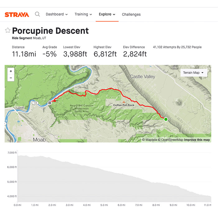
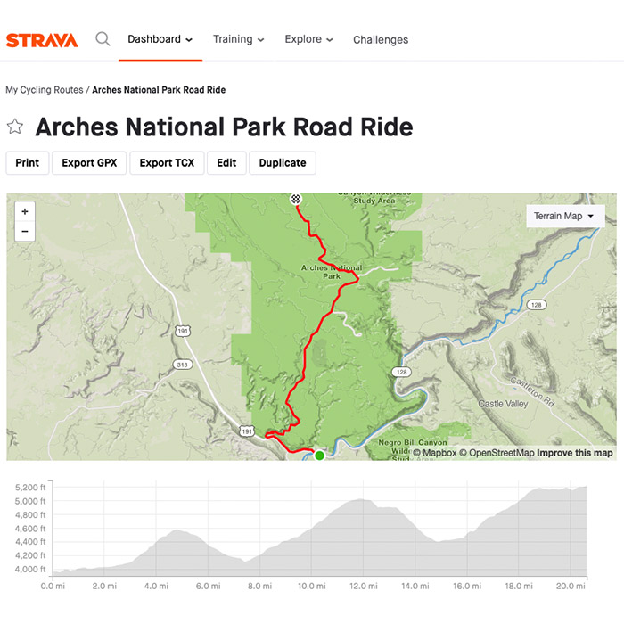
Strava’s route planning tool seems to work best for road biking and gravel biking, but doesn’t have the tools available to plan well for trail and backcountry trips. Here is a road bike ride into Arches National Park that I created using Strava’s ‘Route Planner’ tool. It provides you with an excellent elevation gain profile along with some other useful stats. As you can see in the photo, you can export this to GPX file for your GPS device.
Gaia GPS
One of the go-to tools for explorers, mountaineers, climbers, backcountry cyclists, and map nerds, Gaia is incredible. Gaia GPS was not built with a ‘cycling first’ approach, so its main disadvantage is that it doesn’t assume you will be traveling by bike. Gaia’s advantages are too numerous to mention here, but it excels at planning out backcountry routes that require the use of different types of maps. You must subscribe to the premium version of Gaia to get access to the map overlays, but it’s worth the 20+ dollars a year. Let’s say you are planning a bike-packing trip from Grand Junction Colorado to Moab and you want to figure out how many total miles you will need to ride. Gaia allows you to interlace USGS, Forest Service and their impressive in-house topographic maps and create a seamless route on trails and roads. Even more, Gaia is global. You could plan your next weekend hike or next year’s trip to the Andes in Peru.
Here is an example of a Gaia route for a popular hike outside of Moab.
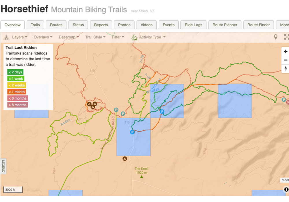
trailforks.com
Most mountain bikers have the app loaded on their phone, and I’m sure most people reading this are familiar. Trailforks is the go-to app for mountain bikers looking for trails. The app is a database, mapping tool, and social app that has most mountain bike trails in existence uploaded to the platform. Trailforks also has a great route planning tool that is mountain bike specific (it does expand to other disciplines also). You can research your rides and map out your specific routes before you get to the trailhead. You can research trail popularity quickly with their color-coding trail overlay that highlights the spectrum of ‘most popular’ to ‘not popular.’ The picture below highlights trail popularity, with the most popular being red and the least popular showing green.
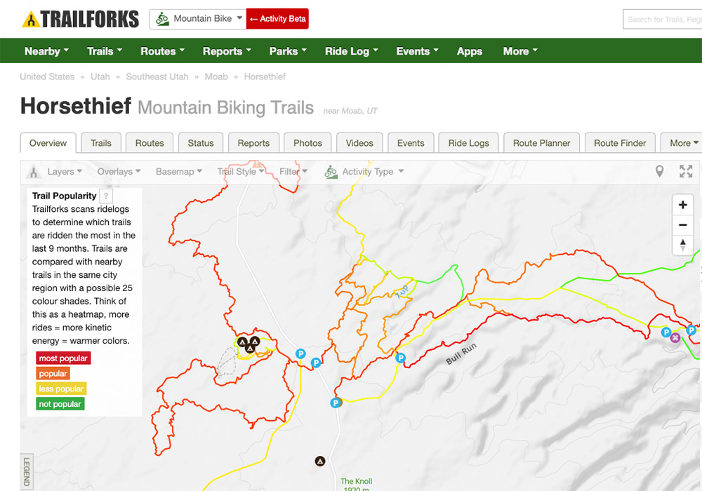
One impressive feature is that trail building organization and land management agencies that maintain the trails are listed on each specific trail’s webpage. Also, you can use their nifty ‘Land Owner’ overlay to learn about where trails cross public and private boundaries. This type of research is useful if you are going to a distant place at some point in the future, and you cannot just look at the ‘live’ or ‘recent’ trail conditions. You might want to reach out to a trail group, or local bike shop to get info on the trail quality. The image below shows a few of these impressive features, such as land ownership and last time the trail was ridden.
The tools above can help you plan your next destination cycling trip. As always, we are standing by in our office if you are ready to go fully guided! As I mentioned before, we are interested in the tools that you use. Please feel free to comment below.
Hope you enjoyed!
Eric Donley
Western Spirit Guide